

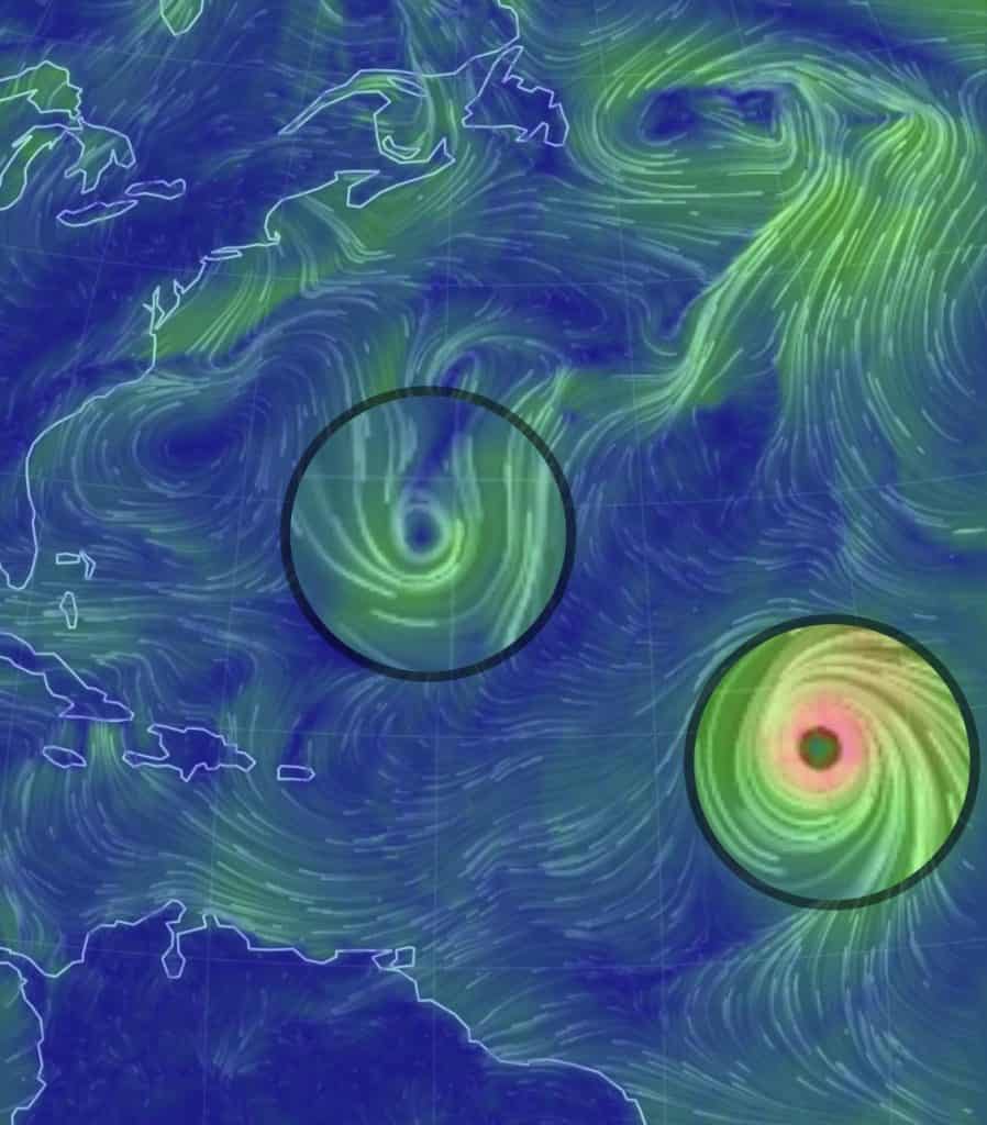
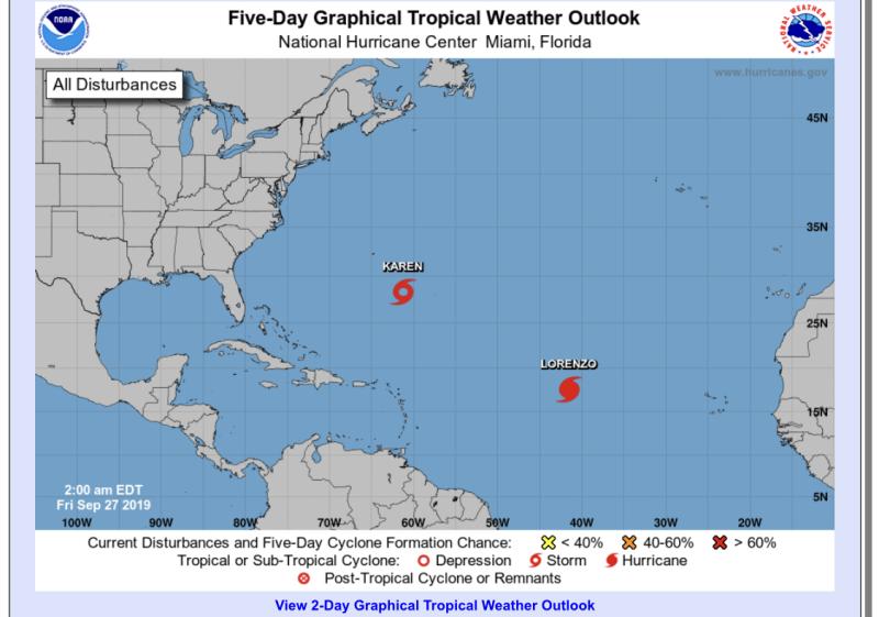
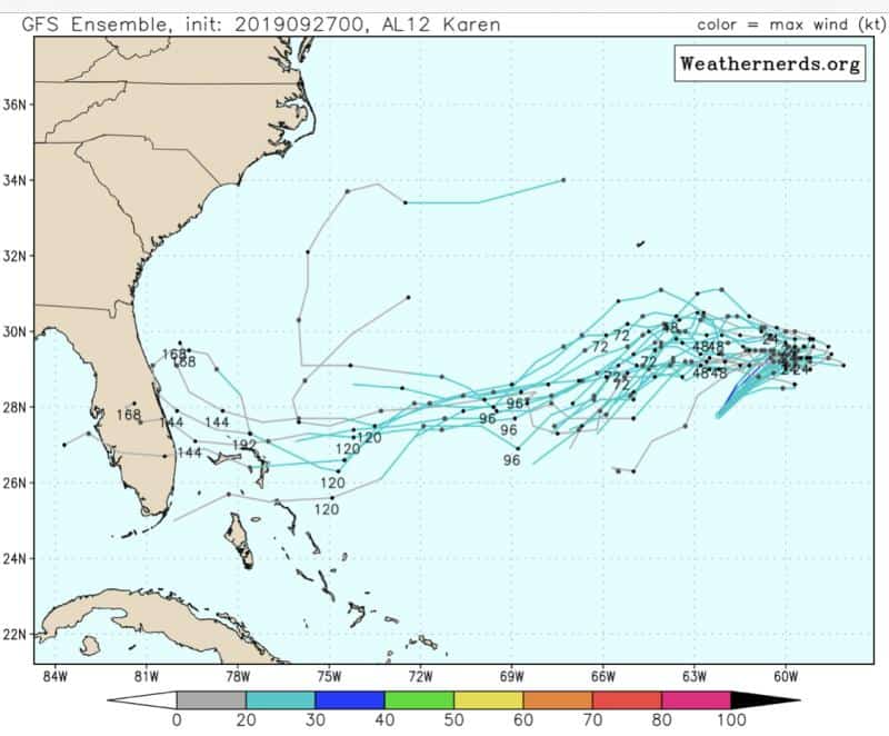
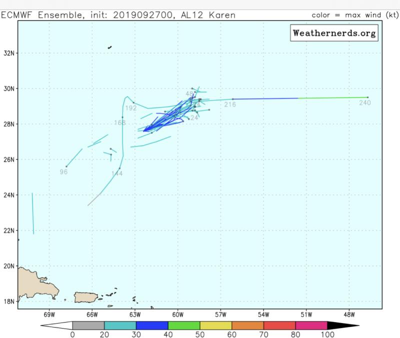
Karen’s winds are down to 45 mph this morning, heading northeast at 8 mph. From radar, it looks like she could be downgraded today if she doesn’t get it together. Models are more in line with Karen’s demise by early next week. Most kill her off well before reaching the Bahamas, and others don’t even see her making it out of her loop-t-loop. She’s still in some decent conditions for developing currently, but this window is closing fast. So this is basically her last chance to survive the loop. If she develops and strengthens today before the stall, we could see a different forecast down the line. So it’s not over, yet I hate to say it.
[/vc_column][/vc_row][vc_row padding_top=”0px” padding_bottom=”0px”][vc_column fade_animation_offset=”45px” width=”1/4″]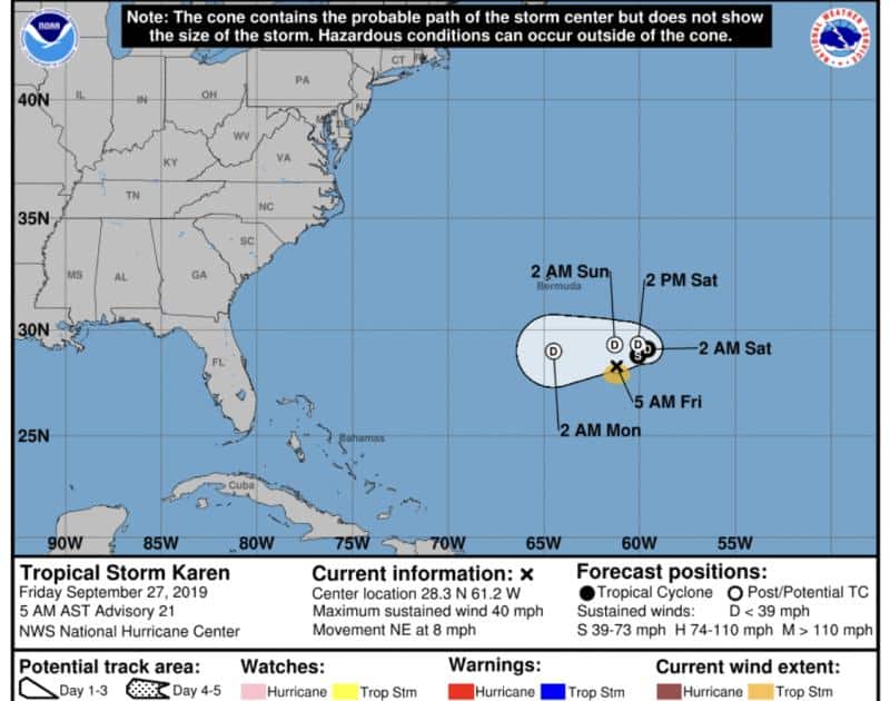
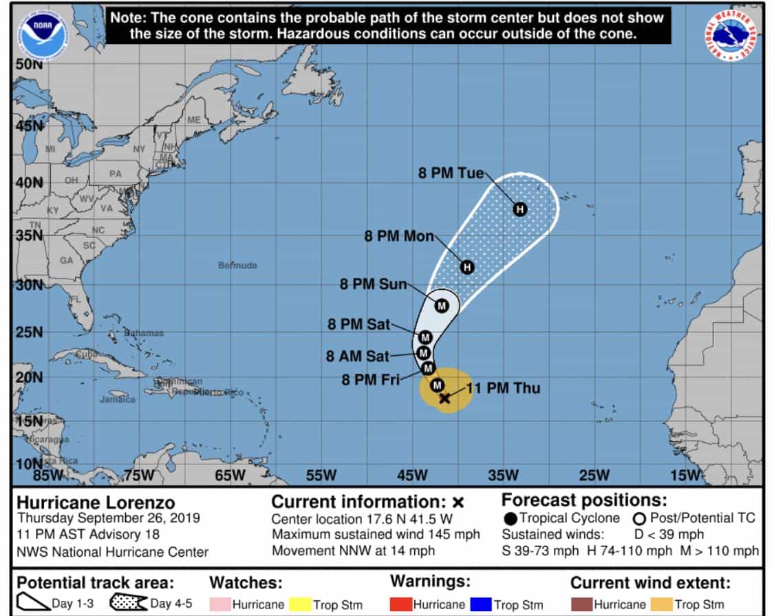
Hurricane Lorenzo is just face slamming protein bars over there in the Atlantic. He’s still a major category 4 storm with winds now at 145 mph. Lorenzo’s still expected to head out to sea, and we all welcome that idea.
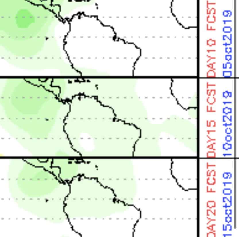
We also need to watch the Caribbean and Gulf in the next 7-10 days. The MJO is picking up some moisture in this area, and models are starting to agree. More to come.


Chad Trosper is the AVP of Catastrophe Claims at Tower Hill Insurance. He has over 19 years of experience in the claims industry and a true passion for weather. Chad graduated from the University of Florida with a degree in Business and Sociology and also holds a master’s certification in Business Process Management from the University of San Francisco. Chad currently resides in Gainesville, Florida, with his wife and three children.