
#1:
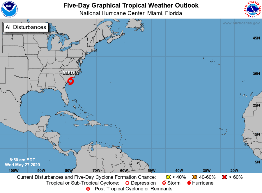
We have a new area that popped up over Florida yesterday bringing lots of rain and a little wind. This area is expected to move into the Atlantic tomorrow, where it could try to develop quickly. The NOAA gives it a 20% chance of development over the next five days, but I assume this will go up by tomorrow.
#2
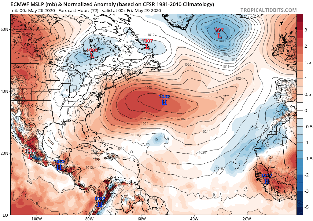
We also have the potential to see another system try to develop in the Mid-Atlantic later this week. Models do not develop it that much currently, but much can change as this is still a few days out. I’m ssuming the NOAA will mark it this week with a small chance of development.
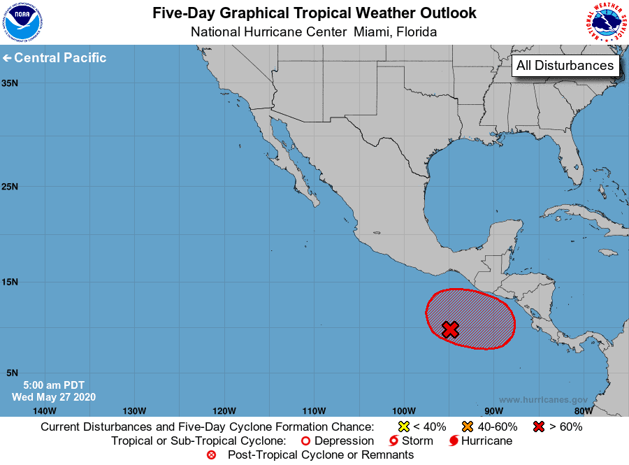
We have a system in the Pacific that should be watched closely. Why? Well, this system has the potential to get pulled over into the Caribbean/Gulf, where it could build. Some models forecast this happening, while others are not yet sold. This is still a long ways out, and lots can and will change, but we should really keep a close eye on this one over the next 7 – 10 days.
Here’s a great Ensemble map that shows the potential chances of development for all the areas noted above: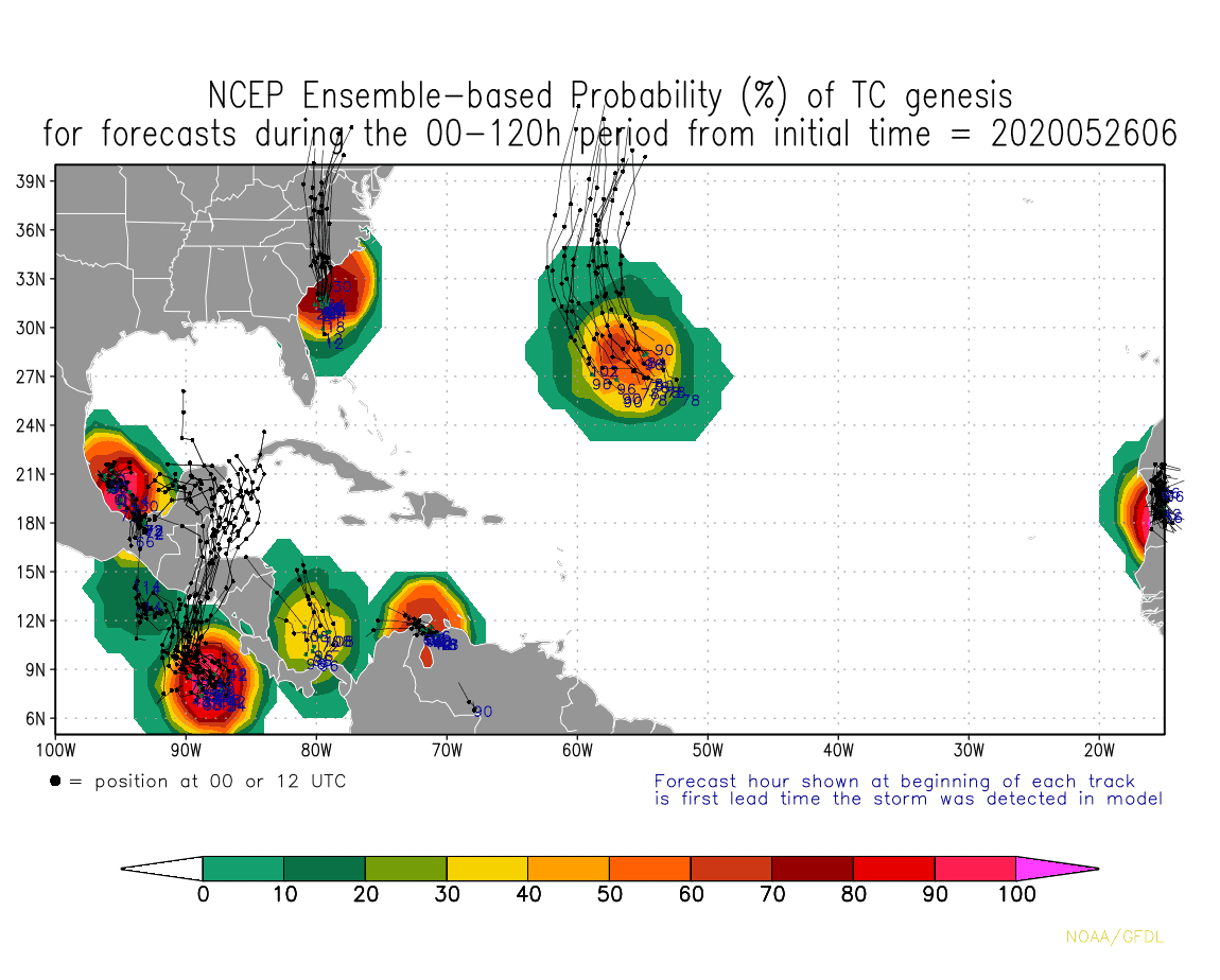


Chad Trosper is the AVP of Catastrophe Claims at Tower Hill Insurance. He has over 19 years of experience in the claims industry and a true passion for weather. Chad graduated from the University of Florida with a degree in Business and Sociology and also holds a master’s certification in Business Process Management from the University of San Francisco. Chad currently resides in Gainesville, Florida, with his wife and three children.