We could see a frontal low dip down into the Gulf near the Panhandle of Florida this weekend bringing some decent rains.
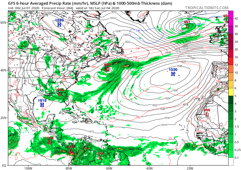
This system is expected to pull into the Gulf this weekend, work its way east across Florida and dip into the Atlantic by Monday.
As for strength? Well it looks like it will be a rain maker for Florida over the weekend, so hold tight on those fireworks panhandlers and north central Floridians. Yup, it could be a wet ride for some folks in Florida trying to celebrate the 4th. Blah..
GFS Precipitation Model – July 4, 2020
Once it gets into the Atlantic by Monday(ish), we could see it try to tighten up and develop some. Models continue to flip flop on this, but several runs have indicated a possible strengthening of this system once it reaches the Atlantic. So, just keep an eye out for now.
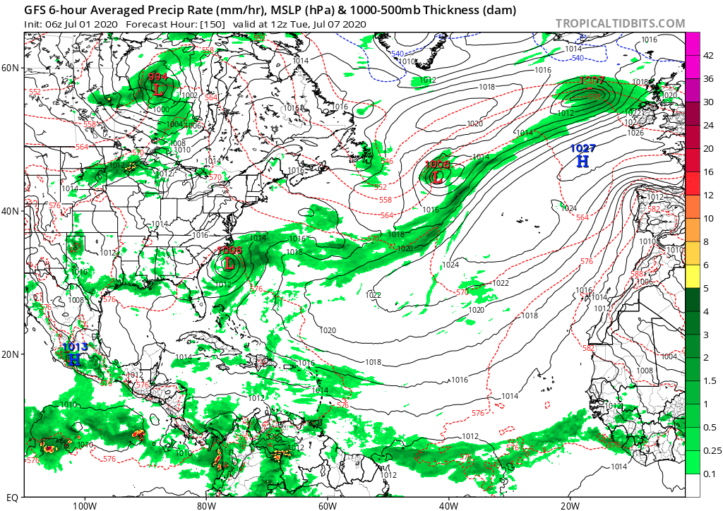
GFS Precipitation Model – July 7, 2020
Regardless, we should see rain for the top half of Florida this weekend for sure.

Chad Trosper is the AVP of Catastrophe Claims at Tower Hill Insurance. He has over 19 years of experience in the claims industry and a true passion for weather. Chad graduated from the University of Florida with a degree in Business and Sociology and also holds a master’s certification in Business Process Management from the University of San Francisco. Chad currently resides in Gainesville, Florida, with his wife and three children.