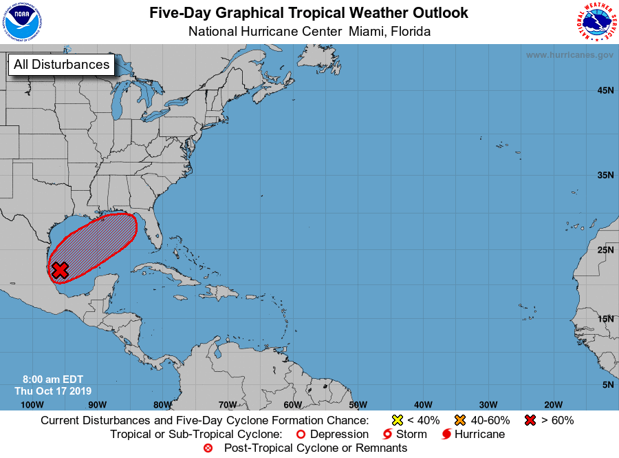
NOAA has Invest 96 at an 80 percent chance of development over the next five days.
The Jet Stream is dipping down and expected to really push I96 eastward across the Gulf pretty quickly starting tomorrow. It’s expected to get from Mexico to the Florida Panhandle in under 48 hours, so you can see how quickly this system is expected to move.
The models are somewhat agreeable on location (FL Panhandle/Big Bend) and timeline (late Friday/early Saturday), but strength is another story.
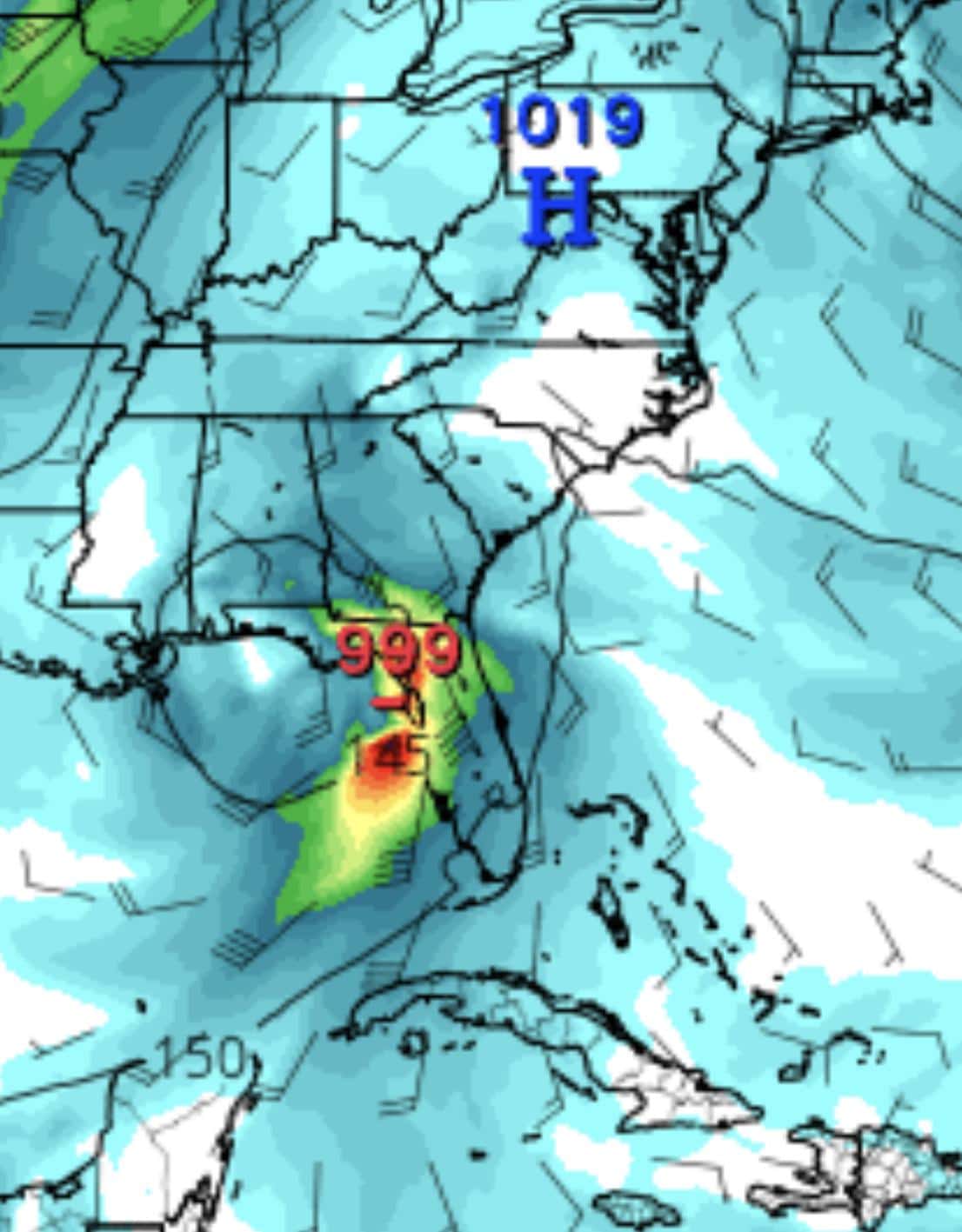
The latest Euro model puts it as a CAT 1 into the Panhandle:
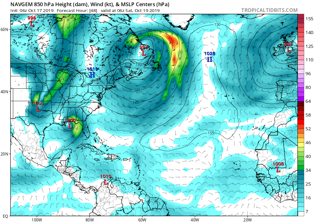
NAVGEM puts it as a tropical depression in the eastern Panhandle:
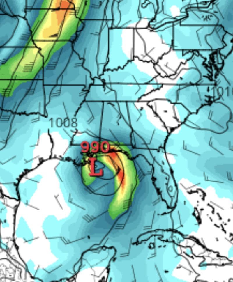
And the GFS puts it as a tropical storm in the Big Bend area:
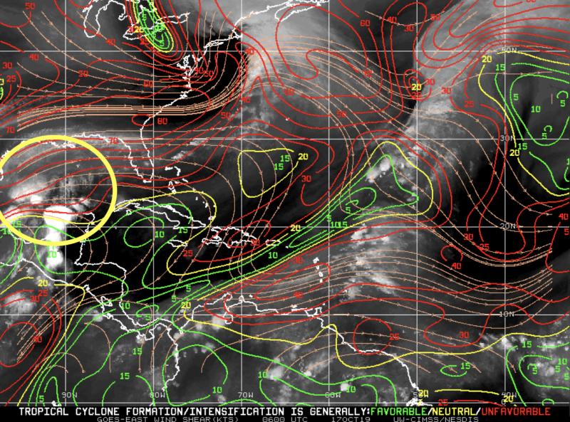 There are some obstacles for I96. Heavy shear and this quick pull east should limit development. With that said, the waters are really hot, so we could possibly see Nestor out of this by tomorrow.
One thing’s for sure, we should expect to see both heavy rains and some decent winds along the Panhandle and through Central Florida this weekend.

Chad Trosper is the AVP of Catastrophe Claims at Tower Hill Insurance. He has over 19 years of experience in the claims industry and a true passion for weather. Chad graduated from the University of Florida with a degree in Business and Sociology and also holds a master’s certification in Business Process Management from the University of San Francisco. Chad currently resides in Gainesville, Florida, with his wife and three children.