Jerry’s faded, Karen’s discombobulated, Lorenzo’s flexing, and Yellow Blob wants some Tex Mex.
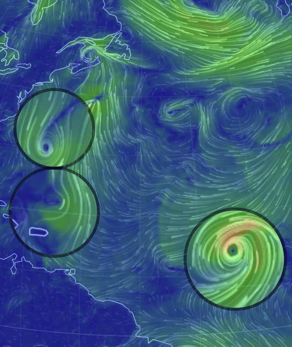
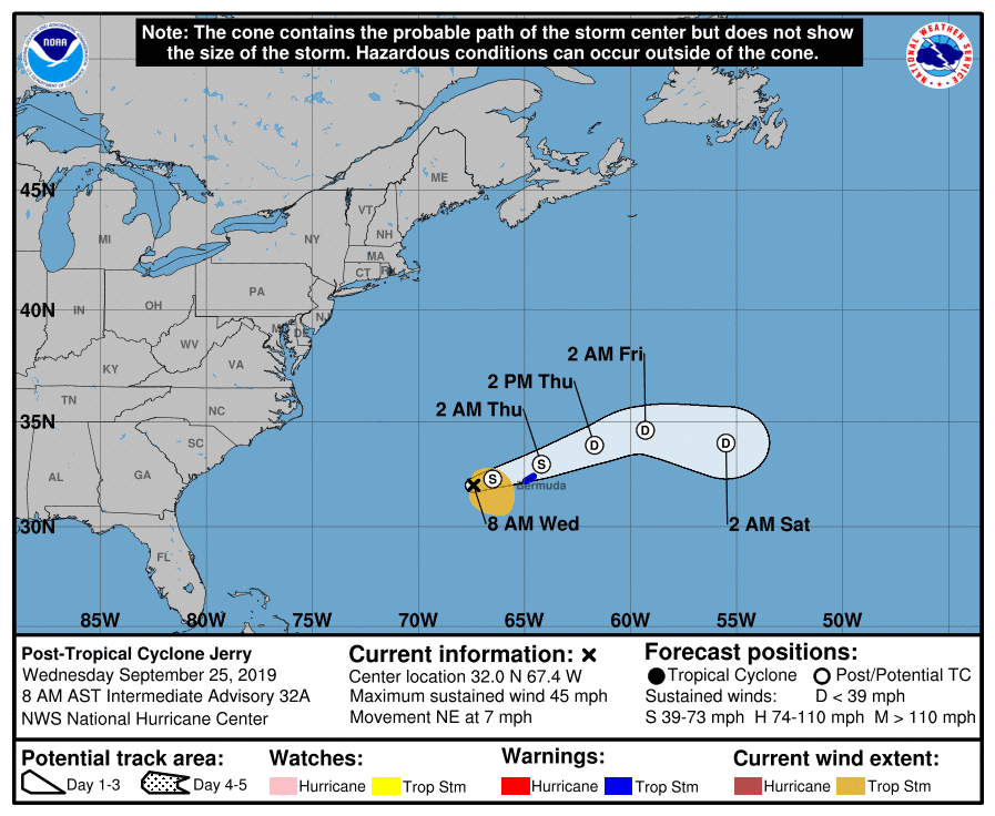
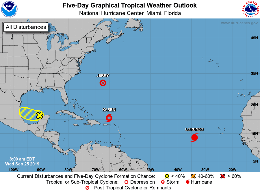 Tropical Depression Jerry looks to be on his last leg and should be gone by end of day. So long J…
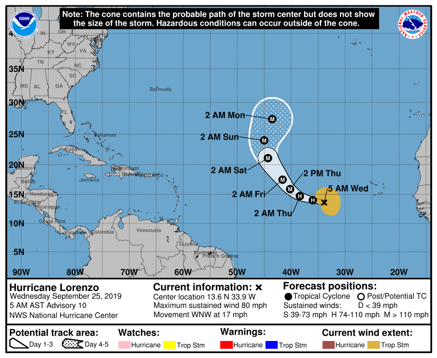
Hurricane Lorenzo, our fifth hurricane for 2019, is just blowing up (aka strengthening) and is expected to become the third major storm of 2019 by week’s end. I also believe that it’s the second hurricane to actually form this close to the African coastline. Regardless, thank goodness it’s a fish storm.
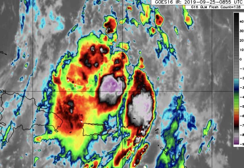
As for Tropical Storm Karen, she’s a complicated one. She’s not looking that organized this morning. Circulation has weakened on the east side wall, and all her storm activity is detached from her center and to the north, so she’s pretty lopsided currently. Karen is headed north at 14 mph with winds at 45 mph. The track is expected to continue north before stalling Friday, then could get pushed around & around & around before heading N, E, W, S, Up, Down?? Most models do agree on the loops and some weakening through early next week, but what happens from there is still a question.
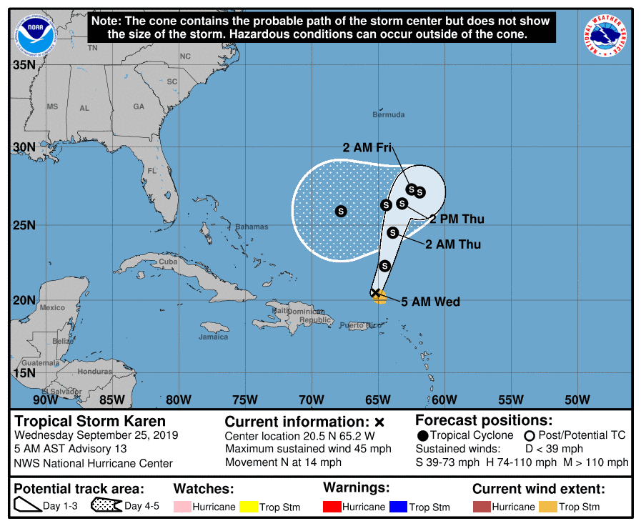
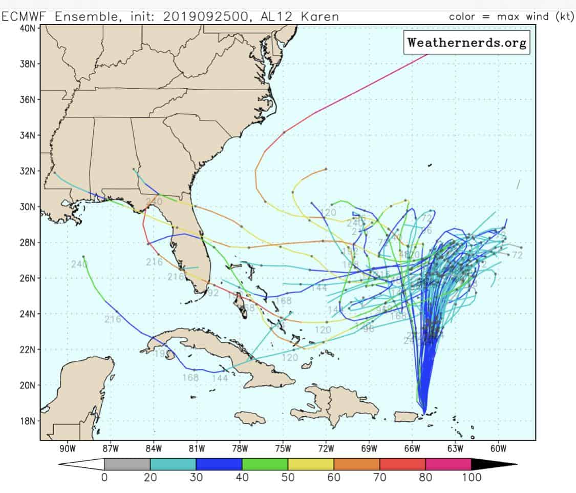
I do think that if she stalls and loops long enough, she could just catch the back end of the passing high and pull back out to sea. Could happen….
Much to watch with this one.

Chad Trosper is the AVP of Catastrophe Claims at Tower Hill Insurance. He has over 19 years of experience in the claims industry and a true passion for weather. Chad graduated from the University of Florida with a degree in Business and Sociology and also holds a master’s certification in Business Process Management from the University of San Francisco. Chad currently resides in Gainesville, Florida, with his wife and three children.