RIP Jerry and Yellow blob. You won’t be forgotten.
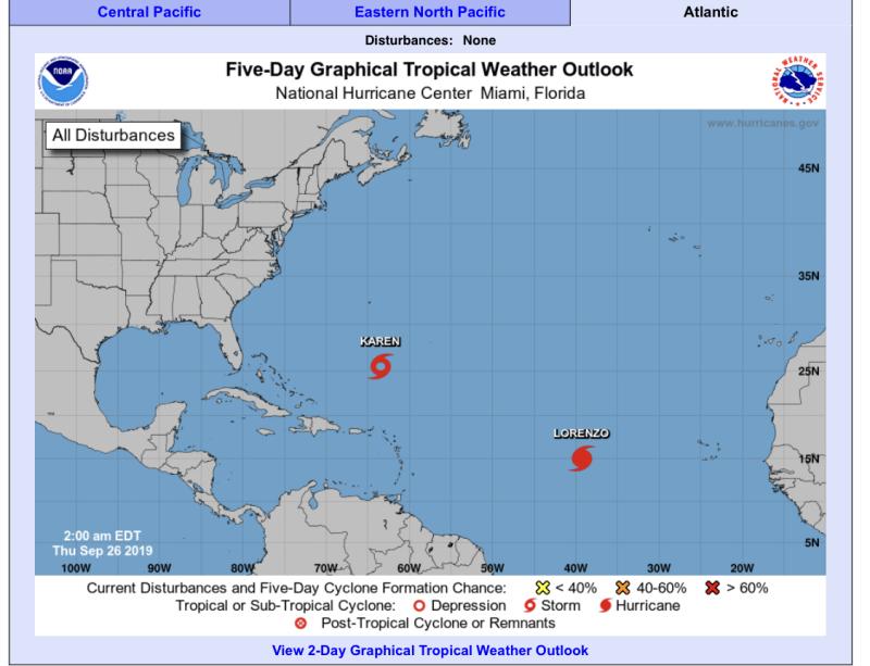
So now we are down to Karen and Lorenzo.
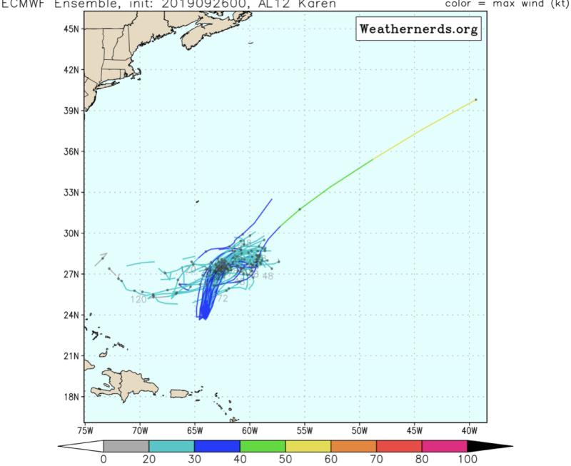
Karen is trying to keep it together but is still disorganized. Winds dropped to 40 mph, and she’s heading more NNE at 15 mph. Models are really on board with Karen hitting the high, pushing west, and then dissolving before reaching the Bahamas. The NHC has even now dropped the strength forecast to a tropical depression going into next week. We still need to watch, as things can change (As we witnessed with Jeanne in 2004).
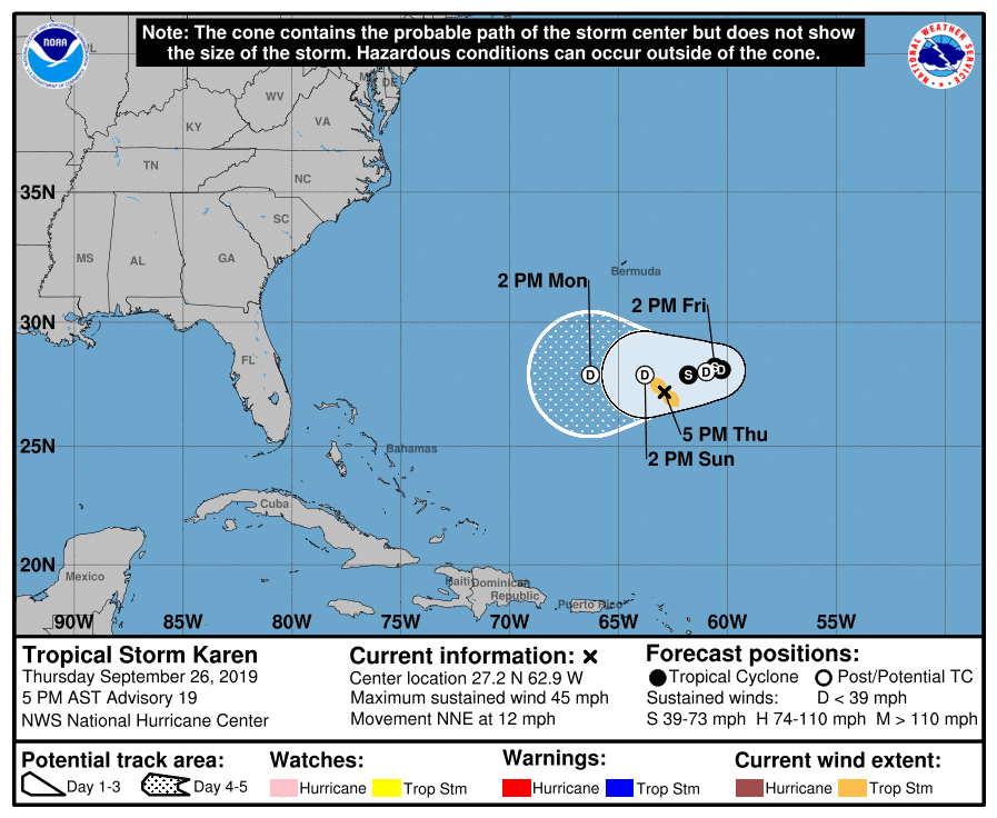
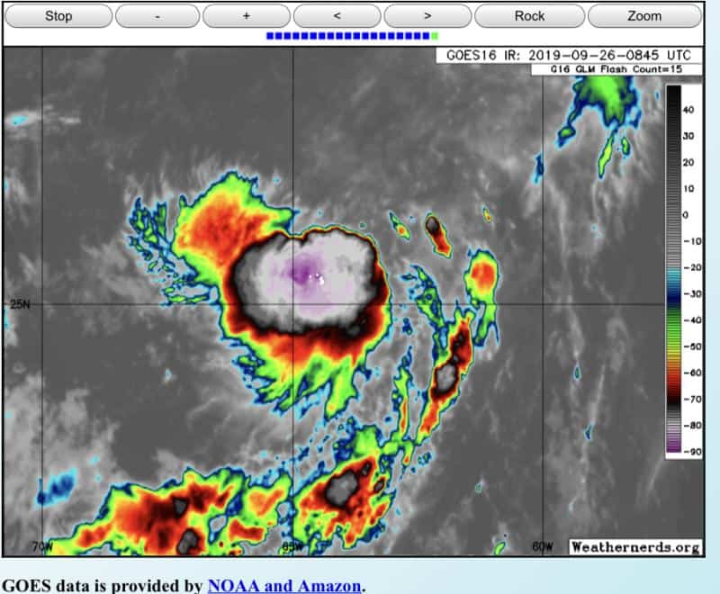
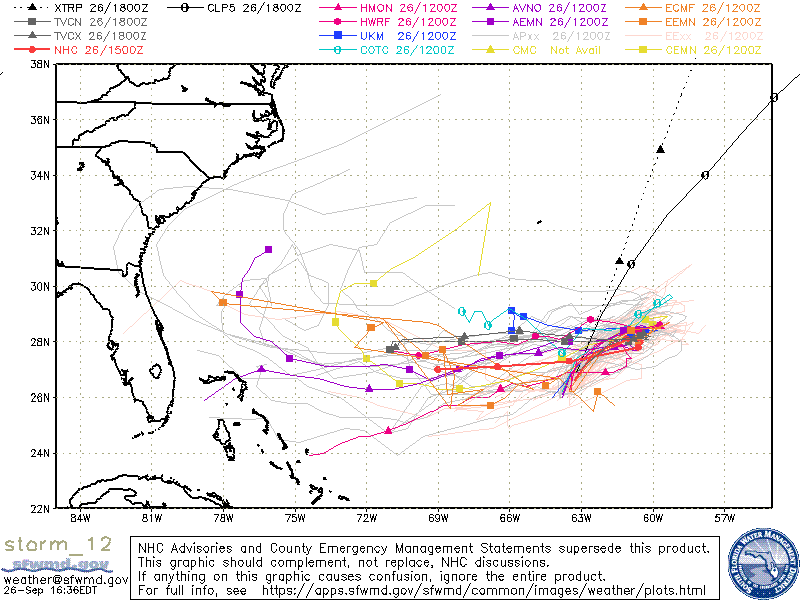
Karen’s in an area with decent conditions right now, so strengthening is not out of the question, but her structure will need a lot of work first.
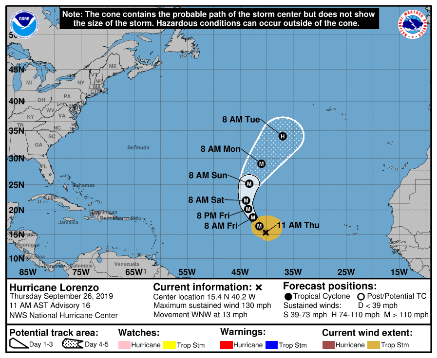
As for Lorenzo, well he’s flexing his muscles as our third major hurricane of the year. Winds are at 125 mph, but he’s heading out to sea. Go on with your bad self Lorenzo. Don’t look back my friend.
We should also watch the Gulf in the next 7 – 10 days, since there could be some moisture pulling up from the Caribbean into the midwestern Gulf. Nothing official, but models seem to be sniffing something out.

Chad Trosper is the AVP of Catastrophe Claims at Tower Hill Insurance. He has over 19 years of experience in the claims industry and a true passion for weather. Chad graduated from the University of Florida with a degree in Business and Sociology and also holds a master’s certification in Business Process Management from the University of San Francisco. Chad currently resides in Gainesville, Florida, with his wife and three children.