Well, it looks like we have another blob in the Atlantic that’s headed toward the Caribbean.
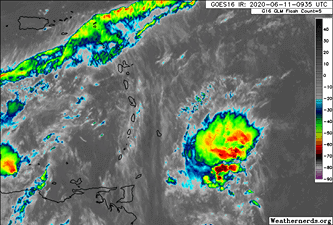
The blob has only a 10 percent chance of development, and most models show it falling apart shortly due to the high shear it’s currently facing.
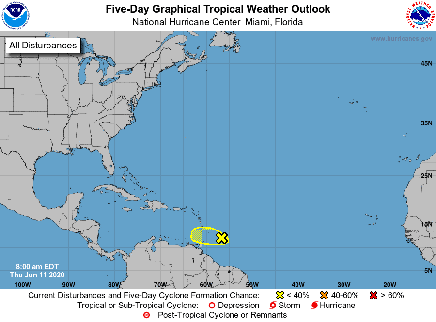
With that said, we could see some of this wave’s leftover moisture pull up and mix in with some existing energy that’s expected to move towards Florida later this weekend and into next week. Nothing crazy development-wise currently — it just looks like rain for the Sunshine State.
There is a bit of good news on the horizon.
The MJO modeling shows a decrease in tropical action starting later next week and lasting through most of the rest of June (Orange is Dry / Green is Wet).
Not saying this is the end all be all, but it’s a good sign that we may get a “tropical breather” for a while. Fingers crossed…

Chad Trosper is the AVP of Catastrophe Claims at Tower Hill Insurance. He has over 19 years of experience in the claims industry and a true passion for weather. Chad graduated from the University of Florida with a degree in Business and Sociology and also holds a master’s certification in Business Process Management from the University of San Francisco. Chad currently resides in Gainesville, Florida, with his wife and three children.