Dorian makes landfall, and systems rolling off the African coast are worth watching.
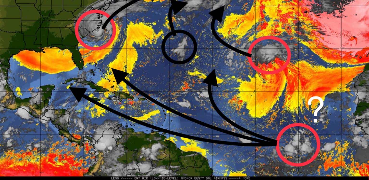
Dorian has made landfall on Cape Hatteras, North Carolina, with winds of 90 mph and heading northeast at 14 mph.
Gabrielle is a post-tropical cyclone now and lost some spunk. She was expected to be a hurricane, but it now looks like Gabrielle will only get to tropical storm status and head out to sea based on current projections.
The other yellow blobs don’t look like they will develop much as they drift out into the Atlantic with Dorian and Gabrielle this week.
The red blob off the African coast is still the attention-getter. Several models are developing it over the week. Some have it going into the Caribbean, some north of the Lesser Antilles and towards the Bahamas (yikes), and some into the mid-Atlantic. There’s not much dry air in its way, and shear is low, so the conditions are there, but it’s in cooler water now, so developing may not happen for a day or two until it hits warmer suds. Still a long ways out, but it’s one to watch.
They also show a second wave expected to come off the African coast shortly that’s supposed to be a gamer.
‘Tis the season.


Chad Trosper is the AVP of Catastrophe Claims at Tower Hill Insurance. He has over 19 years of experience in the claims industry and a true passion for weather. Chad graduated from the University of Florida with a degree in Business and Sociology and also holds a master’s certification in Business Process Management from the University of San Francisco. Chad currently resides in Gainesville, Florida, with his wife and three children.