Dorian is currently over the Lesser Antilles as a tropical storm with winds at 50 mph and heading WNW at 13 mph.
Winds have dropped from yesterday’s 60 mph estimate. The Air Force Hurricane Hunter fly-through confirmed wind speed at 50 mph and system pressure at 1004 millibars.
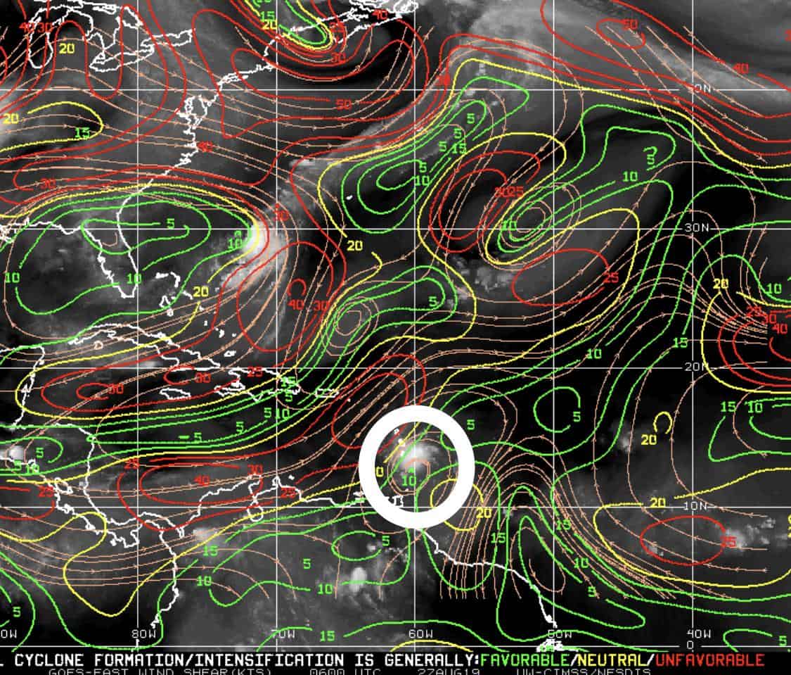
Dorian is tiny. I mean thunderstorm tiny.
Dorian will face some obstacles in the Caribbean. Drier air and heavier shear are ahead. These can easily wreck a small system like Dorian.
The NHC has Dorian tracking WNW and turning more north later today through Wednesday. They still show a hurricane by Wednesday as it nears the Dominican Republic. The forecast then has Dorian split the islands, missing direct land and pulling out as a tropical storm headed towards Florida this weekend.
If Dorian hits the islands directly (either Puerto Rico or the DR), then we should see some decent weakening, but missing these land masses allows for more strengthening.
Models are all over the place on Dorian. The EURO & GFS both take Dorian into the central east coast of Florida as a minimal tropical storm late Sunday. The CMS and NAVGEM strengthen it into a hurricane and take it on a more westward track over Miami & the Florida Keys.
Lots to watch, as these tiny systems are hard to predict.

Chad Trosper is the AVP of Catastrophe Claims at Tower Hill Insurance. He has over 19 years of experience in the claims industry and a true passion for weather. Chad graduated from the University of Florida with a degree in Business and Sociology and also holds a master’s certification in Business Process Management from the University of San Francisco. Chad currently resides in Gainesville, Florida, with his wife and three children.


