Marco has fizzled out and is expected to drift along the Louisiana coastline as rain. As for Laura, we could see a major hurricane develop pre-landfall.
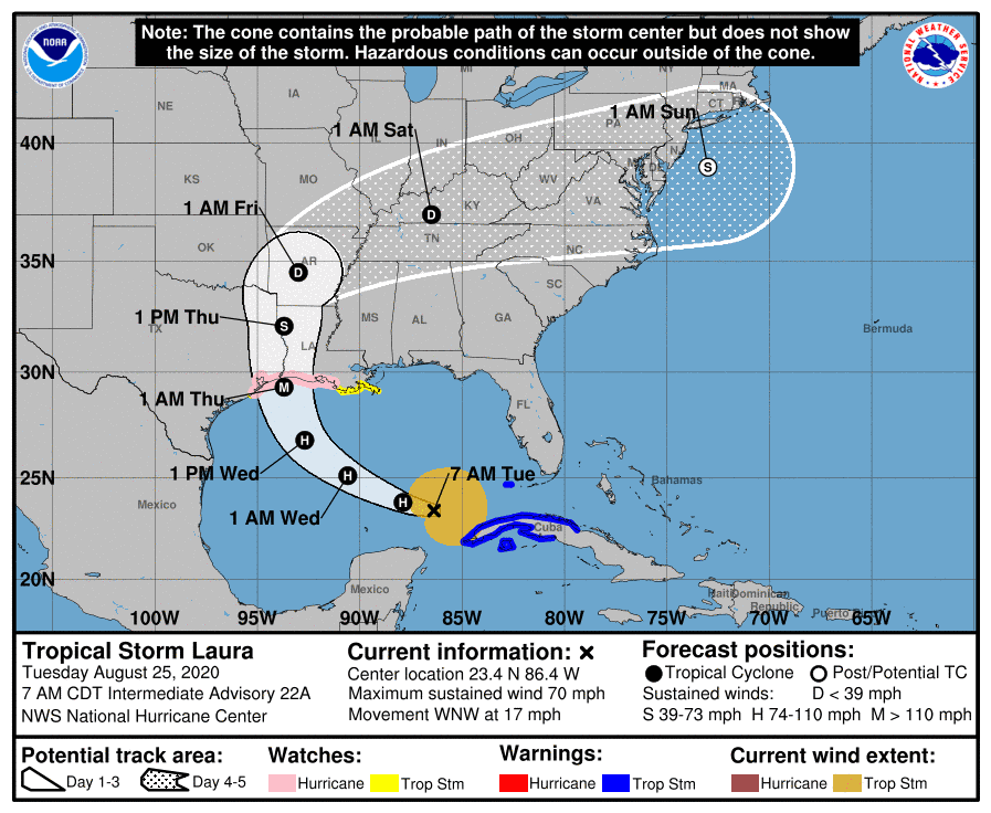
Currently, Laura is a tropical storm with winds at 70 mph (74 mph is hurricane), headed WNW at 17 mph.
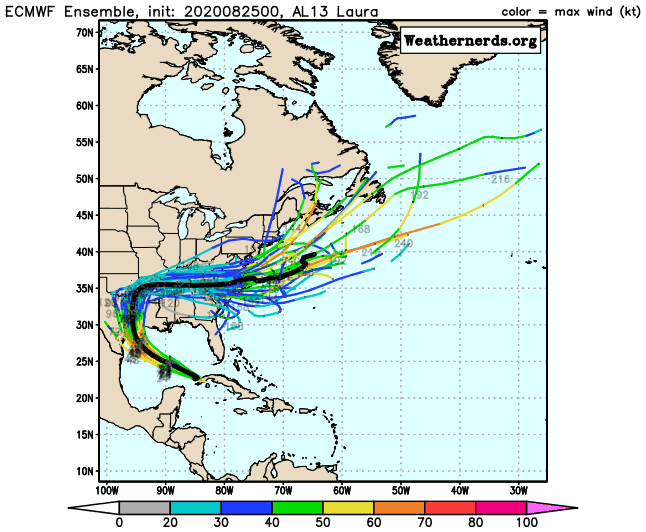
NHC track has it headed for the Texas/Louisiana border and making landfall early Thursday morning as a CAT 3 (115 mph) hurricane.
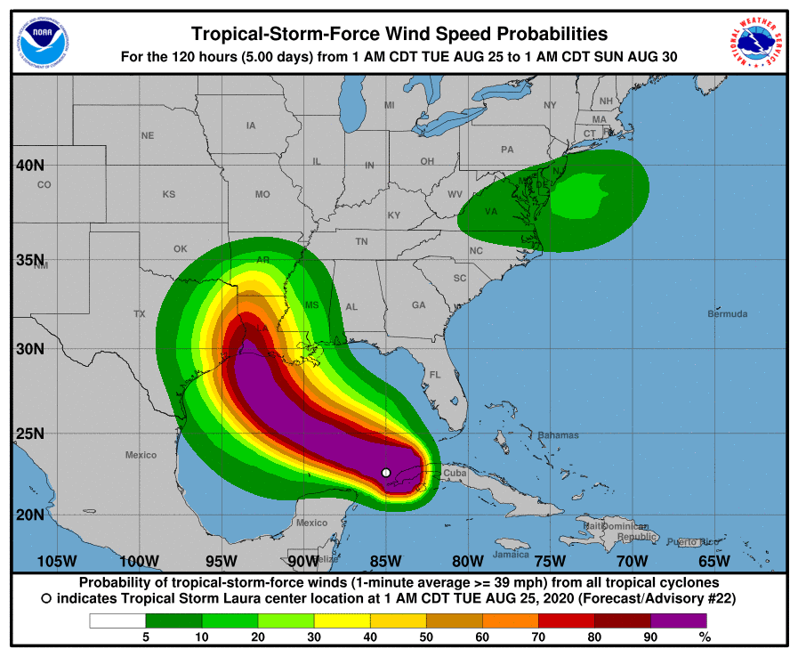
We still could see changes in both strength and track over the next 48 hours as it travels over the open Gulf.
Conditions are currently optimal for development and look to remain this way for the most part through Thursday, so we could easily see a major hurricane even earlier.
We could also see a drift westward in track since modeling has been trending some on a west shift closer to Texas.
Lots to watch over the next 48 hours.

Chad Trosper is the AVP of Catastrophe Claims at Tower Hill Insurance. He has over 19 years of experience in the claims industry and a true passion for weather. Chad graduated from the University of Florida with a degree in Business and Sociology and also holds a master’s certification in Business Process Management from the University of San Francisco. Chad currently resides in Gainesville, Florida, with his wife and three children.