Invest 93 has graduated to Tropical Depression 3 with 35 mph winds and is currently doing a seven point turn in the Bay of Campeche at 3 mph.
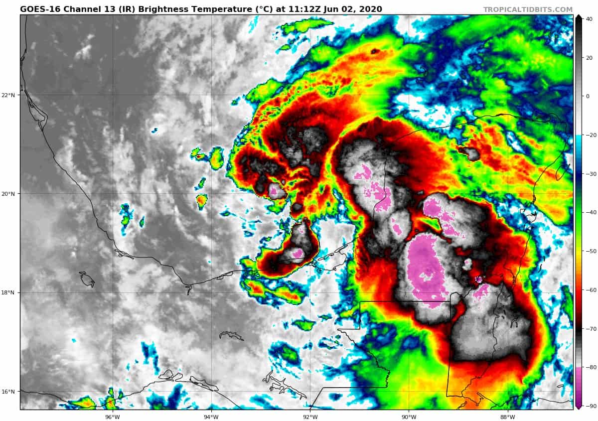
TD3 is expected to sit the in the Bay for a few days as it organizes some. Then it is expected to venture out into the Gulf later this week.
Once named, it will be called Cristobal.
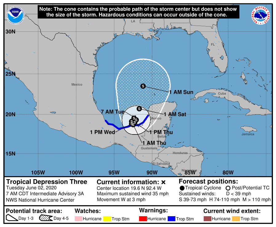
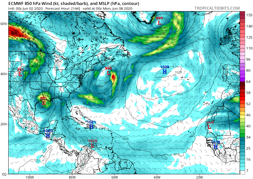
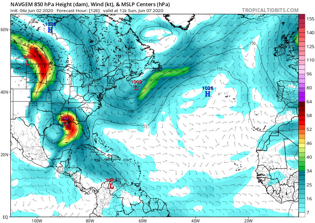
Most models have TD3 pushing out into the Gulf later this week, strengthening into a tropical storm, and reaching the Texas/Louisiana border by Monday.
The only model that is not 100% on board with this, is the NAVGEM.
In my opinion, the NAVGEM is a really good model for location, so I am curious to see if some of the other models shift more east over Louisiana in the next few days.
As for strength, most keep it as a tropical storm, but the EURO is more aggressive and strengthens it into a strong category one hurricane.
As for my thoughts, I think that we could see a strong tropical storm to minimal hurricane form in the Gulf by this weekend. If TD3 does strengthen enough, it could fight against the push westward from the expected high pressure, and we could see more of a mid-Louisiana/Mississippi impact. Again, this is just my opinion for now.
Lots to watch.

Chad Trosper is the AVP of Catastrophe Claims at Tower Hill Insurance. He has over 19 years of experience in the claims industry and a true passion for weather. Chad graduated from the University of Florida with a degree in Business and Sociology and also holds a master’s certification in Business Process Management from the University of San Francisco. Chad currently resides in Gainesville, Florida, with his wife and three children.