Two systems show potential for development over the next few days.
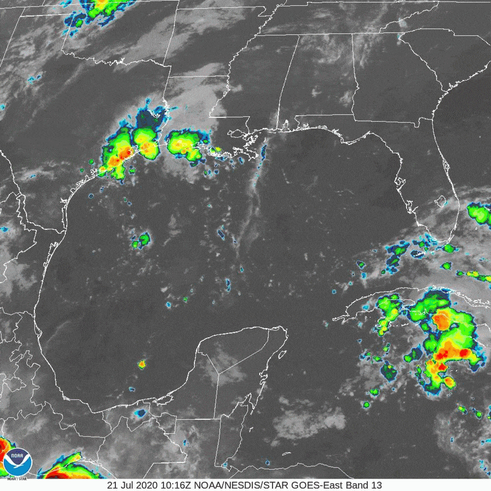
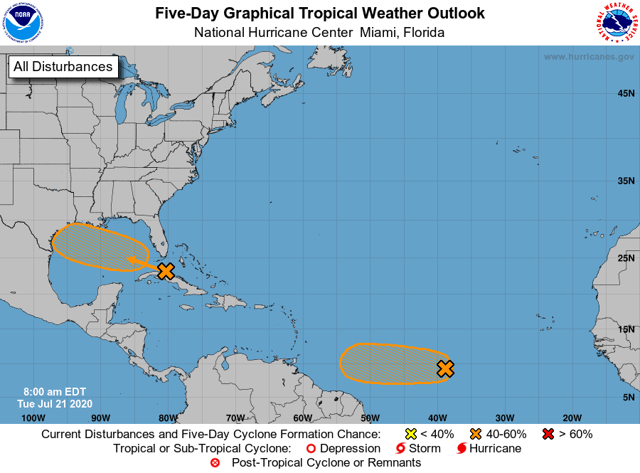
Gulf system:
- Currently located between Cuba and Florida
- Up to a 40% chance of development over the next five days
- Models still not developing it much, but ensembles are hinting at possible strengthening closer to the coast.
- Timeline is still Friday/Saturday
- Most modeling has it headed towards mid-Texas, but based on current upper winds, we could see a shift more NNW in track, placing it more towards Louisiana/Texas border.
- Need to watch as a slow in speed could shift track and allow for further strengthening.
- Tropical depression/tropical storm development is possible.
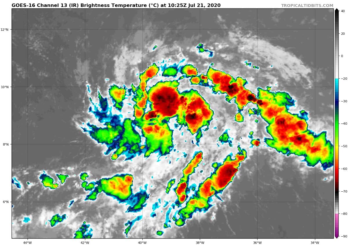
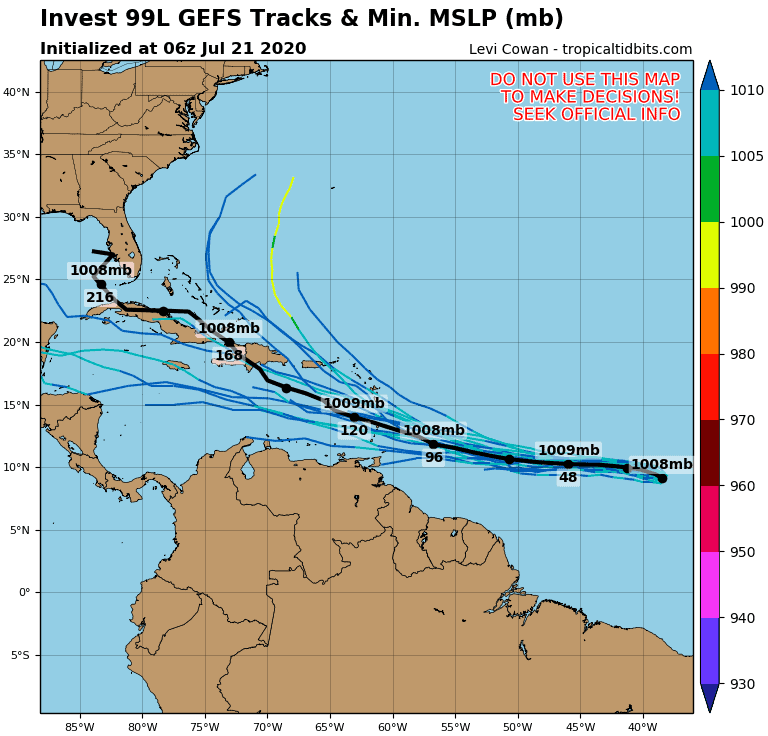
I99L:
- Up to a 60% chance of development over the next five days
- Headed towards the Lesser Antilles
- Once past the islands, most models have it falling apart as it drifts further into the Caribbean.
- I99 has a decent circulation and seems to be strengthening currently.
- Possible tropical depression formation is there prior to reaching the Antilles.
- We will have a better idea of I99’s plan once past the Antilles in the next 5 – 6 days.
We’re also watching the possibility of a wave coming off the African coast late this weekend into early next week. This one, if it happens, could be a distance runner that would require attention.
Nothing official, just a heads up.

Chad Trosper is the AVP of Catastrophe Claims at Tower Hill Insurance. He has over 19 years of experience in the claims industry and a true passion for weather. Chad graduated from the University of Florida with a degree in Business and Sociology and also holds a master’s certification in Business Process Management from the University of San Francisco. Chad currently resides in Gainesville, Florida, with his wife and three children.