We could have a tropical depression by this weekend or early next week.
There’s a lot going on now in the tropics for sure. Here’s what we have:
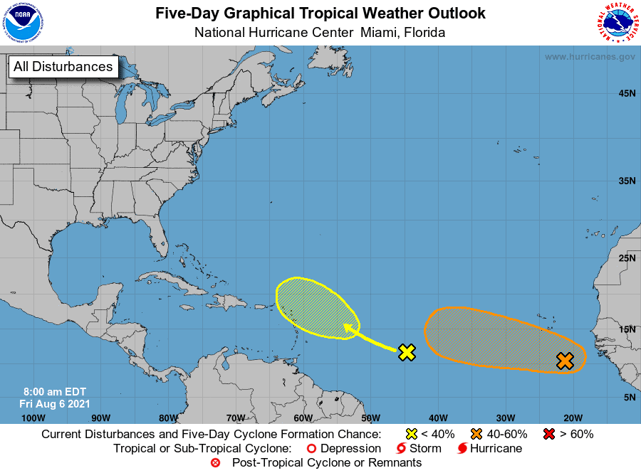
- Our yellow blob has a 20% chance of development. Don’t count this one out, though. We could see it push energy very close to the East Coast by late next week. Will that energy regroup? Currently, models say no, but conditions are there. Regardless, it could help fuel our newest invest down the line.. Watch this one.
- Our orange blob is now invest 92L and has a 60% chance of development. Models do show 92 tightening up quickly as it pushes northwest over the next few days. Some also keep it together for a while before fading, but there is a lot of dryer air ahead of it, so it will have its challenges. With that said, we should watch closely as it could get close to the East Coast, but most tracks do have it pulling up before then. Keep watching.
- There’s a third, you ask? Yup, we could see another one come off the African coast early next week. This one could be a low rider, and if you follow me, you know that low riders can make it to the Caribbean. This is a no-no for Gulf Coasters, so we’ll need to keep an eye out for this wave. Could be a gamer…
So that’s where we are, folks. Next week could be interesting.

Chad Trosper is the AVP of Catastrophe Claims at Tower Hill Insurance. He has over 19 years of experience in the claims industry and a true passion for weather. Chad graduated from the University of Florida with a degree in Business and Sociology and also holds a master’s certification in Business Process Management from the University of San Francisco. Chad currently resides in Gainesville, Florida, with his wife and three children.