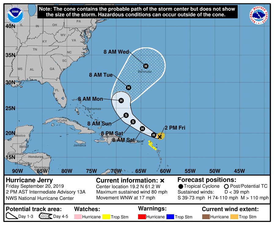
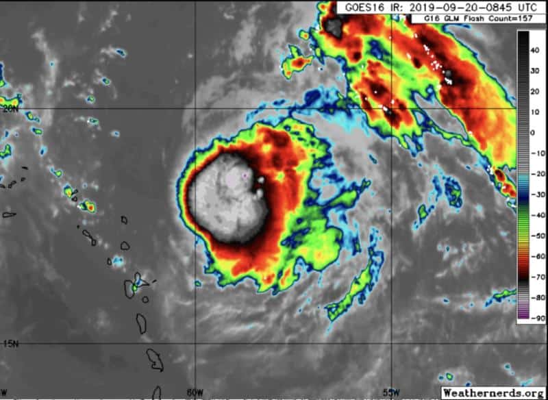
Hurricane Jerry is our fourth hurricane of the season and is currently a Category Two storm with winds at 100 mph and heading WNW at 16 mph.
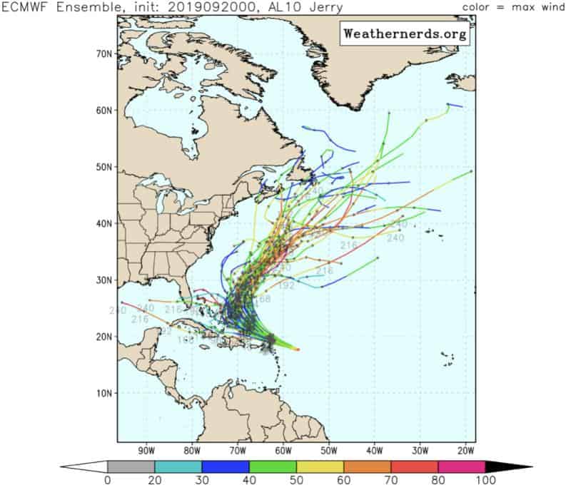
Crazy how Jerry intensified with so much shear and dry air around it. Imagine what it could’ve been without these limiters. Yikes…. It still has a lot of shear ahead of it, so I’m assuming that’s why they don’t predict J becoming a major down the line. It’s still expected to take that curve this weekend out to sea. Another bullet dodged??
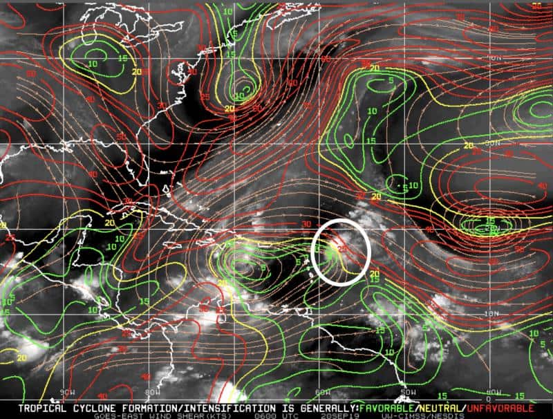
Our two yellow blobs are not impressing the models, so their five day development chances remain low. However, we should watch closely if they drift into the Caribbean, IMO.
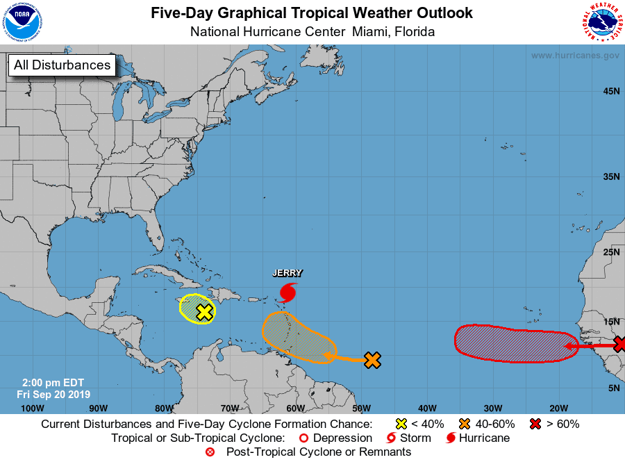
And finally we have our red landing pad for the wave I’ve been mentioning coming off the African coast next week. Models love this wave and develop it quickly. The silver lining currently is that Jerry should help pull it north. “Should”.
Lots to watch.

Chad Trosper is the AVP of Catastrophe Claims at Tower Hill Insurance. He has over 19 years of experience in the claims industry and a true passion for weather. Chad graduated from the University of Florida with a degree in Business and Sociology and also holds a master’s certification in Business Process Management from the University of San Francisco. Chad currently resides in Gainesville, Florida, with his wife and three children.