I still remember one season when someone commented that all these blobs were “the attack of the balloon animals.” Not sure why, but that still makes me laugh to this day….
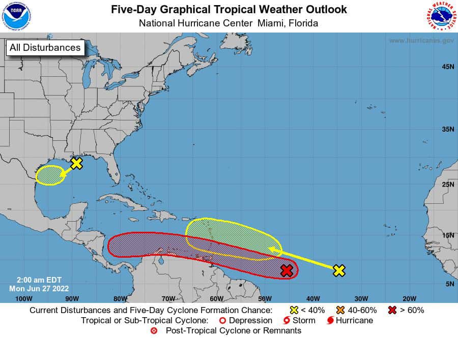
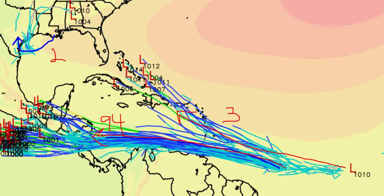
Anyhow, it’s heating up for sure out there, and we have three areas to watch now….
First:
I94 is at a 90% chance of development over the next five days and could become our second named storm, Bonnie, by end-of-week. Models keep this red balloon on a WNW path away from the Gulf. So whatever it does become, it shouldn’t mess with us.
Next:
Our second balloon that just dipped into the Gulf remains at a 20% chance of development. Models aren’t doing much with this little guy or gal for now and push it west towards Texas as a little rain cloud (Tutt Tutt, Looks Like Rain).
Next:
We also have a third system riding I94’s coattails. NHC gives this one a 20% of development as well. Now this yellow mooch could be sneaky. Models show it getting yanked up more northwest by the end of the week, causing it to hit dry air, land, and shear that ultimately dismantles it. BUT. And this is a Big BUT… If this system avoids that early pull north and continues on this southern westward track, then it could have a better chance of building before pulling up down the line. Most models do not really entertain this, but worth watching just in case.

Chad Trosper is the AVP of Catastrophe Claims at Tower Hill Insurance. He has over 19 years of experience in the claims industry and a true passion for weather. Chad graduated from the University of Florida with a degree in Business and Sociology and also holds a master’s certification in Business Process Management from the University of San Francisco. Chad currently resides in Gainesville, Florida, with his wife and three children.