Tammy Is Born | CAT365

October 19, 2023 | Chad Trosper, BPMP

Share this Post

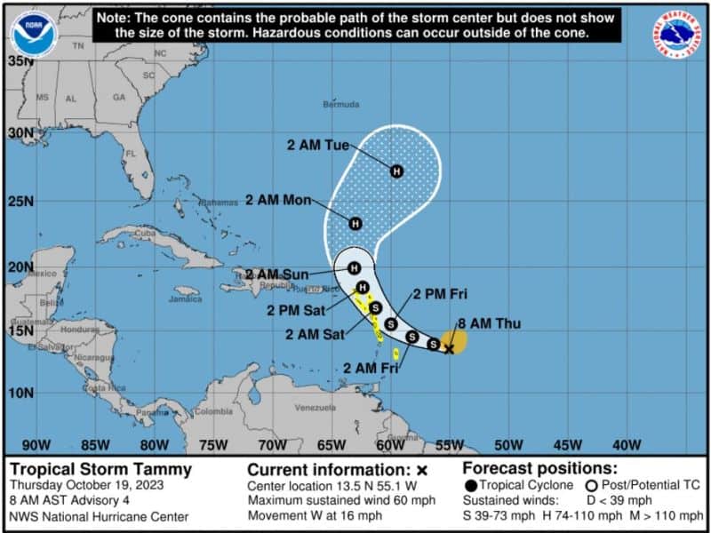
So we have TS Tammy now (Prior I94) with winds at 60mph.

We expect to see this strengthen into a hurricane over the next week. Models continue to pull Tammy north once near the Antilles, so U.S. impact is not expected from this one. But, behind Tammy, we have a decent wave. This one could push into the Caribbean and assist with some potential Caribbean Creeper DNA. As I mentioned last week, models have been pinging potential Caribbean energy pushing up sometime next week. Well, this could be that energy it has been sniffing. Still way out and NOAA not showing interest in this back wave for now, but assume it will soon. All in all, we should steer our tropical focus to the Caribbean as this will be our Hot Spot for the rest of the season. Still have a ways to go and we all know we should never let our guard down until January.
For now, enjoy the cool air in the south. Gives us Floridians a chance to whip out our hoodie with shorts and flops outfits.
Stay tuned folks.